Book 2 Route Changes. Stratford-upon-Avon to Charmouth
Monarch's Way 625 miles

Monarch's Way - An Introduction to a 625 mile footpath

Monarch's Way T shirts and Hoodies

Monarch's Way Guide Books & Badges

Maps & Postcards of the Monarch's Way

Cotswolds Guide Books & Maps of the Monarch's Way

Trevor's Memorial Bench

Fastest Known Time

Contact Page

Warwickshire - The Monarch's Way

Monarch's Way in Poetry

Janet's Book 1 Walking Blog

 Route changes in book 1

Route changes in Book 2

Route changes in Book 3

"PRICES SLASHED" Satmap Digital mapping of The Monarch's Way

"New" Minder Opportunities

 Temporary Amendments to The Monarch's Way

Monarch's Way Hall of Fame

Places to Visit along The Monarch's Way

Favourite Links

Walks Around The Monarch's Way

Bird News along The Monarch's Way

Amanda's Charity Walk Ham Hill to West Bay

Oak Apple Day 29th May 2012 Guildhall Worcester

'Bulletin Bytes'

The Monarch's Way in 47 days

Changes to the Route of the Monarch's Way

Minder's at work along the Monarch's Way

Trevor Antill ACIB

Trevor's Boot Relay Pictures

Trevor's Boot Relay Pictures part 2

Trevor's Boot Relay Pictures part 3

Trevor's Boot Relay Pictures part 4

Trevor's Boot Relay Pictures part 4A

Trevor's Boot Relay part 5 Book 2

Trevor's Boot Relay part 6

Trevor's Boot Relay part 7

The Monarch's way Relay part 8 (updated)

The Monarch's Way Relay part 9

The Celebration into Charmouth-Trevor's Boot Relay part 10

The Monarch's Way Relay part 11 Book 3

The Monarch's Way Relay Part 12

The Monarch's Way Relay part 13

King Charles II

The Monarch's Way Relay part 14

Photo Page 3

Trevor's Boot Relay "Shoreham"

WHAT'S NEW PAGE

Favorite Links Page


NEW Monarch’s Way Route along Section 20A GreenWay to Campden Road

Background

This section running from the Greenway at Long Marston alongside the former Long Marston Airfield

has always been very difficult to maintain. The track is very narrow in many places and hemmed in

by the hedge on one side and a farmers fence on the other for a long part of it. I did request

alterations several times to widen the footpath to improve it but none were forthcoming at all.


The farmer did cut the hedge but only once a year in September / October due to rules

on Nesting Birds. This resulted in the route being overgrown for most of the main walking

period of the year. I had good support from the former minder of that section Michelle but

even us both spending many days there every year it was an uphill struggle. Part of the route

along Doctors Field was very bad too.


When I recently visited that area to meet with one of the new Minders of that section Kevin

and hand over some clearing equipment I noticed a new cycle way / footpath running from the

entrance to the new Cala Homes site along Camden Road the B4632. It continues past the point

where the Monarch’s Way crosses the road. This opened up opportunities as previously walking

along the busy road with fast flowing traffic and no footpath would have been very dangerous.


 When I met Kevin he explained to me that very very recently a new Trackway had been created

from the Greenway linking right through the Cala Homes development as far as Campden Road.

At this stage it was very easy to decide to alter the route to take advantage of these improved

opportunities. The new route is now fully waymarked and should be far easier and less hazardous

to follow than the old route.


I am currently in discussion with Cala Homes to place a new post where the new Track leaves

the Greenway to show the route to Kings Lodge for those walkers who wish to see the position of

the place where the king is thought to have stayed during his escape


The New Route description is as follows

From Kings lodge retrace your steps south along the Chipping Campden / Welford Road to

then turn left at the first junction – signed for Quinton. Soon reaching the level crossing

go left along The Greenway – the old railway track – as far as the level crossing (Wyre Lane),

signposts an Railways Cottage that you have noted before.

Go straight over this junction towards Stratford-upon-Avon, stay on the greenway for 200m

until you reach "airfield crossing" here go right and take the new tarmacked path/cycle way

(walkers should keep to the left hand side). Follow this path for 1.5kms, passing an extensive

new housing estate on the old Long Marston Airfield, until you reach the B4632. Cross the road

at the pedestrian lights, then turn right along a tarmac path and follow it for 200m. Here

turn left and go through a kissing gate to enter a fiel

The route description continues as it was before continuing to Lower Quinton and onwards 


The map below shows the new route in red.


Its only an approximation as the OS mapping does not show the position of the very new trackway.


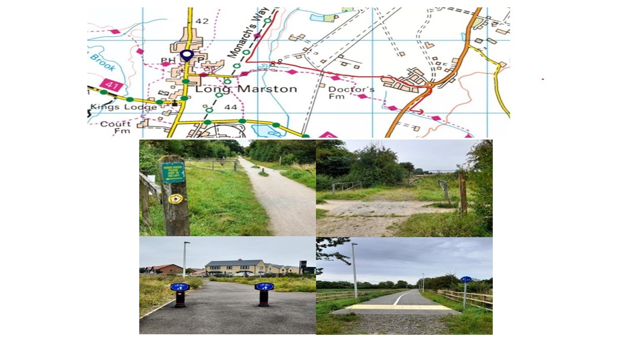
Amend 01. Book 2. Section 30 Keynsham to Abbots Leigh. Page 55.


When joining the river bank again after Kings Park Avenue, walkers MUST take one of the following alternatives.

At many times this short, unmade section of the riverside path can be flooded and very very DANGEROUS after and during flooding. 

When I tried to walk this section large parts of it was covered it deep tidal mud and it was thoroughly unpleasant and very Dangerous too. The TIDES come in very rapidly and you could get TRAPPED


One of either of following routes below Must be followed.


Alternative Option (1)


Soon passing under first a railway bridge, ignore Cole Road on the left and continue forward with the Feeder Road. Immediately passing under a major road flyover bridge and then take two smaller bridges, ignore Atlas Street on the left (which is a no through road anyway) and so take the next left which has  no name sign but is Short Street. Follow Short Street which then  becomes Albert Crescent, and continue forward with it to eventually pass under a railway bridge to arrive at a traffic island. Here go left along Albert Road for about 150 yards where on the right go through gates into a recreation ground- Spark Evans Park. Now bearing right arrive at the made-up riverside cycle/footpath where you turn right to resume your route. 


Alternative Option (2)

Having rejoined the Feeder Road it is possible to simply follow the road (next) to the feeder canal itself, (which is of interest) until after almost ¾ mile reaching the traffic lights at Avon Street where a right turn over the bridge brings you back on route.


Amend 02. Book 2. Section 30 Keynsham to Abbots Leigh. Page

Leaving the SS Great Britain continue forward and at the junction with Crescent Avenue turn right and continue along the pavement. Ignore the footbridge over the pavement and continue forward. The riverside footpath has collapsed and has been blocked off by Bristol Council.


 "NEW 17/04/2014" Amend 02 Book 2. Section 31 Abbots Leigh to Winford. Page 62.


Starts last paragraph 5th line on page 62:


“You are now back on the definitive line. In the field walk forward and up to pass through a (gate or stile – fence under construction) in a fence. Continue forward and up from here, across the field centre, to a wide gap in the field boundary opposite. Through this continue forward to with the right hedge/wall to a corner gate.


Go through this gate, across a track and through another gate. Walk forward aiming for a telegraph pole just beyond the left hand fence. Arriving at the fence you meet a stile which you cross into another sloping field. Keep on the same line, with the telegraph pole on your right, to meet a metal gate with a step stile welded to it. Go over this stile.


Ahead are striking views across the Chew Valley, with its reservoir, to the Mendip Hills.


Now walk down the long, steeply sloping field to the farthest bottom right corner and a double gate onto a lane; the gate is just right of a triple ridged barn on the opposite side of the lane. Cross the lane (it is signed Winford Lane / Dundry Lane) to the Bristol gate opposite. Enter the field and walk straight down it towards the field gate in the opposite hedge. (The Mendip TV mast on the horizon is to the right of this gate.) Go through the gate and continue forward and down, pass just left of the protruding right-hand field corner and then follow the right hedge to a concealed footbridge in the furthermost bottom right corner of this long sloping field.


You are walking under the flight path into Bristol Airport. Winford village is the settlement in the valley below right.


Cross the stiled footbridge into another field and so follow the right hedge down to the next corner where there are two step stiles in quick succession which take you through a few trees. Go over these stiles, go right with the fence and in about 40 yards go right through a gateway into an adjacent field. Here go across the field, cutting the bottom corner, to a stile. Crossing into a field corner walk forward with the left hedge/ fence to the next corner and though a metal field gate (or over the step stile to its right). Now heading directly for the church tower, pass under the aqueduct, to a footbridge and step stile.


The aqueduct is a Bristol Water pipeline taking water from the springs at Chewton Mendip to Barrow reservoirs.


Over these cross a small field to the slab stile into the churchyard. Passing immediately right of the church exit the churchyard at the main gate.


You are now in Winford village, a pretty place and the end of this section. 


Section 34 Wells to Castle Cary

Pages 81 new book 2 paragraph 3


On the left is the start of trees. Cross through a gap into trees and walk forward for around 30 yards, until a left pointing waymarker (nb do not walk forward on the more obvious path as it is very steep and slippery). Continue left with, first barbed wire and then an over grown wall to your left. Keep with it, at the top of a slope to reach another stile. Over this continue  the same line, but now almost on the edge of a field with a barbed wire fence on your right. Follow the fence onto the field edge itself. stay with it to reach a dip and a step stile in the fence. go over the stile and into the tree to walk forward and then swing left with the path.


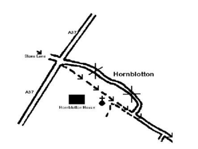
The A37 (Fosse Way) has over the past 11 or 12 years become busier and faster so much so that it is now considered time to find an alternative route that is more comfortable to follow. Whilst the alternative provided has a longer stretch of tarmac than the A37 stretch it is along a relatively quiet country lane.

For this a new sketch map and narrative now follows.

Delete from “At the road ... “ at the start of the fifth paragraph on page 82 to, and including “Turn left into the green lane” at the beginning of the third sentence of the fifth paragraph on page 83 and substitute:


At the road go right for just a few yards to a field gate on the left immediately past Batch Farm Cottage. Go left through this gate into a field and now go forward and slightly right to reach the far corner. Here go over a ditch crossing and a stile into another field corner. Now walk forward with the right hedge for approximately one third of its length. At this point is a double stile and ditch crossing in the hedge. Crossing these will bring you into another field where you continue forward with the hedge on the left and heading for a small cluster of corrugated buildings.

These are light aircraft hangers for a landing strip, for you will also see windsocks and evidence of a small landing strip close by the footpath. 

Passing between the hangers and the left hedge will bring you to a footpath junction and in front of you, a gap into another field corner. Go through the gap and follow the right hedgerow to the next corner and another gap. Through this into another field go slightly right across the field to a gate in the opposite fence/hedge line- being a bearing of (255 degrees) this will take you across a corner to the end of the landing strip.


Through the gate and in the next field go across the centre aiming for the gate in the opposite hedgerow which is immediately left of a house. At the gate go through it onto Stone Lane. Turn left to follow Stone Lane for about a mile all the way to the busy A37 (Fosse Way). Carefully cross over into the green lane opposite.

Amend 04. Book 2. Section 34 Wells to Castle Cary Page 83.

"Carefully cross over the A37 into the green lane opposite where in a few yards, and on the right you will see a wooden footpath signpost, a ditch crossing and a step stile Cross the stile into a narrow strip of trees where you bear slightly left to quickly come to another step stile. Over this and into a large field now walk diagonally left, on a bearing of 130 degrees and walk left of a tree and aiming left of a church spire in the distance. Following this straight line you will eventually arrive at a crossing paddock fence which will leads you to a gated kissing gate and so through onto the drive in front of the church".

Now follows the paragraph in italics that describes the church and which remains unchanged of course. So now substitute the next text for the first few lines of the following paragraph.

“If you are not visiting the church then turn left and so pass through a gate across the drive. On the other side follow the semi-surfaced lane forward to a junction with a minor road where there is an old road sign for the church. Here go left (forward) to ……


Amend 05. Book 2. Section 36 South Cadbury (Camelot ) to Trent Page 93.

Now that we can be sure o its public status this alternative route avoiding the 500 yards walk up the B3148 can be offered. Although this route follows more tarmac road walking than the route originally described it is less busy and as such you may wish to follow it. The description is now follows:

When adjacent to the farm buildings instead of going right along the hedged unsurfaced lane (Moorway Lane) continue following your surfaced lane as it rises through bensds and then woodland (Bowden Hill) to meet a golf course and a surfaced lane on the left. On the right is an unsurfaced track/lane (Coombe Lane). Here go right along Coombe Lane and follow oit for a little under a mile all the way to the B3148, joining a surfaced drive from Coombe Farm at a bend for the last few yards. At the B3148 turn left for just a few yards and then right (Carefully crossing the road) into the broad, hard core surfaced lane, Checcombe Lane.


Amend 06. Book 2 Section 38 Ham Hill to Crewkerne page 106

Prior to the sale of one of their farm properties, Somerset County Council created a number of public rights of way, two of which enable The Monarch’s Way walkers to avoid following the busy A356 for the third of a mile between Chiselborough House (GR 46351475) and Byme Bridge (GR46101445). The two rights of way (one footpath, one bridleway) follow a line adjacent to the road but within field boundaries.

As a result of this excellent display of initiative by the highway authority please make the following amendment at page 106, 4th paragraph:

After “240 degrees” delete the rest of the paragraph and insert....

“This will bring you to a gated step stile in the right hedge. Do not join the A356 but instead turn left and follow the field edge, keeping the hedge on your right, until reaching the inverted corner of the field. Here turn left for short distance to a kissing gate and so cross a lane to a hedge gap on the other side. Through this continue your forward (south-westerly) direction to pick up the hedgerow next to the A356 and follow it to meet the bank of the River Parrett where you pass through a hunters gate and now turn left”.

Now simply follow the next paragraph text as existing.


Book 2 Section 38 Ham Hill to Crewkerne Page 107 line 29. The path diversion around Rushywood Farm has now been way marked. Diversion signs are in place to indicate the correct and new route.  

The original route is shown below as a blue line; the New Route follows the red line.  This allows improved access through Rushywood Farm, significantly reducing interaction between the Farm Activities and Walkers.

 
Amend 07. Book 2 Section 38 Ham Hill to Crewkerne page 107

Following confirmation of a statutory diversion of footpaths Y11/8 and Y11/6 (Haslebury Plucknett) please amend text as follows. At line 3 paragraph 5 on page 107 and after “four trees” delete from “... and so... “ all the way to ”.... the bottom left corner” at the end of the first sentence in the last paragraph on the same page.

In its place insert:

“in front of the gate in the protruding corner of the hedgerow opposite – an overall bearing of approximately 250 degrees- swing left on a farm track and then immediately go right and left again to keep the hedge on your right and which you follow to the next corner. Here go through a dual purpose field gate cum wicket gate in front and continue forward again with the hedge on your right to meet a power pole and gate on the right. Here continue forward to cross a step stile/gate in front and so continue following the right hedge. At the next corner cross the step stile/gate in front onto a concrete farm road. Turning right follow the road through a gate to continue forward to pass immediately left of very substantial farm buildings. This will bring you to a T-junction with another crossing farm track which you cross to the ditch crossing and step stile in the hedgerow a short distance in front. Entering a large sloping field go slightly left down the slope (overall approximately 240 degrees), on the way crossing a farm track, and so arrive at a step stile in the left hedgerow well above the bottom left corner.”

Now follow the original text apart for substituting “step stile” for “gate”.


Amend 08. Book 2 Section 40 Hawkchurch to Charmouth page 117

This is not a route diversion, just additional information.

 Insert Pound Lane in the sentence  ie “Here go left and steeply up the tarmac lane (Pound Lane) to reach a cross-roads”. 

Add in

“Passing this way on one occasion we stopped to chat to a local resident who, in the course of conversation, told us that the unsurfaced green lanes you have just followed were used as a naturally camouflaged storage area for armoured vehicles prior to the Normandy D-Day landings in 1945”.

Then continue “At these crossroads” as before.

Section 39 Crewkerne to Hawkchurch Page 111 Paragraph 3.

The map below shows a proposal; for a path diversion to the north west of West Swilletts Farm. I understand that this diversion is now operational. and so you should follow the line shown on the map BFECDA.

(NEW) Amend 09. Book 2 Section 39 Crewkerne to Hawkchurch P 112 & P 113 & P114

This is an alternative to the route specified in the Guide Book. The B3165 is a very busy and potentially dangerous road. This alternative route although not way marked avoids this busy road section.


On reaching the B3165 junction,(P 109 section 39 final paragraph) instead of turning left along the road, turn right along the road for approx. 50m. Cross the road carefully before the right hand bend very near an old red Phone Box and look for FP signpost on the left just on the bend. Take the path through an overgrown area to a stile in left hand corner of this area. Cross stile and proceed diagonally right up the hill to the top of the ridge (Blackdown Hill). Take the footpath WSW which drops down to Causeway Lane. Turn left and rejoin the Monarch’s Way 50 yards after farm buildings and after an evergreen tree (P 110 of my copy, paragraph 1) go right to a gate/stile and into a field. 


1. p.113 1st para. of walking text. The new housing development means that the field gate is now some 50m from the road. To avoid any doubt I suggest the following revised wording to replace the second and third sentences:
“Immediately after the school entrance go right along a tarmacked path, signed as a footpath, with some new houses on your left, to a field gate, proceed straight ahead into the field.” 
 
2. p.114 2nd para. The line of path has been slightly altered by the solar farm. To avoid doubt suggest the following revised wording of the first sentence and amend the start of the second sentence to read:
“In the field (you are now under the power lines) go left to the near corner and then right and head for the gate ahead in the fence line, a short distance away from the left hand hedge. Through the gate and straight ahead to the step stile ....”
New Flood Damage to Section 40 Hawkchurch to Charmouth

ROUTE BLOCKED AHEAD. (Update 25th October 2014)

The stream now has two planks of wood across it, they are however very slippery after any rain or during the winter time and the better option to continue with the diversion below as it is safer. 

P.117 3rd PARA. The route at the culverted stream is blocked following the collapse of the culvert in recent storms and is impassable. There is a short convenient alternative as follows:

“At the waymarked bridleway on your left, which you are told to ignore, take this bridleway. Go through the gate and diagonally downwards to cross a stream. The bridleway then enters a field and rises upwards. Follow for about 50 metres until the field opens out. Then turn half right and head for the top right hand corner of the field where there is a gate and adjoining stile. Cross the stile onto the access track to a house turn right and almost immediately left onto the green lane that you were previously on and continue as before (You are at the point in the text where “you will meet and merge with an unsurfaced road coming in from the left...)”.


Page updated 21st February 2024