

Monarch's Way - An Introduction to a 625 mile footpath
Monarch's Way T shirts and Hoodies
Monarch's Way Guide Books & Badges
Maps & Postcards of the Monarch's Way
Cotswolds Guide Books & Maps of the Monarch's Way
Warwickshire - The Monarch's Way
Temporary Amendments to The Monarch's Way
Places to Visit along The Monarch's Way
Walks Around The Monarch's Way
Bird News along The Monarch's Way
Amanda's Charity Walk Ham Hill to West Bay
Oak Apple Day 29th May 2012 Guildhall Worcester
Changes to the Route of the Monarch's Way
Minder's at work along the Monarch's Way
Trevor's Boot Relay Pictures part 2
Trevor's Boot Relay Pictures part 3
Trevor's Boot Relay Pictures part 4
Trevor's Boot Relay Pictures part 4A
Trevor's Boot Relay part 5 Book 2
The Monarch's way Relay part 8 (updated)
The Monarch's Way Relay part 9
The Celebration into Charmouth-Trevor's Boot Relay part 10
The Monarch's Way Relay part 11 Book 3
The Monarch's Way Relay Part 12
The Monarch's Way Relay part 13
The Monarch's Way Relay part 14
|
This is a series of walks in the Long Ashton part of Bristol created by Tony Hibbitt and reproduced with his permission General Information (this applies to all walks on this page). All walks are on tracks and paths and some are by streams so be prepared for mud. There may be stiles to cross, some are easy but some have no steps. There may be farm gates some of which are easier to climb than open. Please be aware that these routes have not been checked for some time. All routes start and finish at The Little Tipple (50 Weston Road, Long Ashton). The roads encountered are shown in bold type. Before using any pubs and cafe's mentioned it may be very wise to discover if they are still open. Importantly not all paths are "Rights of Way", some are "Permissive" so please do not abuse them.
|
|
|
From The Little Tipple carefully cross the main road to the opposite bus stop and continue ahead to pass the shops and the library. At the end of Lovelinch Gardens turn left and first right into Bradville Gardens. At the junction turn left into Fenshurst Gardens, then first right into Paulman Gardens. At the end of the cul de sac go down the footpath and turn left. Immediately after crossing the railway turn left on a wide path, which later crosses a stone bridge and turns away from the railway. On nearing the bypass go through a kissing gate, turn right and then left to go under the by-pass; the path is to the right of a concrete tunnel. (Parts of this walk are on a national long distance trail The Monarch's Way). Cross the board walk, or (walk along side it as the boards can be slippy). Go up the stony path by the stream, cross a stile and concrete bridge (no hand rail) and go up a slope to cross a stile into a hedge-lined path. At end cross a stile into a field and continue downhill to cross two more stiles. Then bear left to cross a stile by a gate. Cross the next large field going up and diagonally to the right. The Wood ahead is Barrow Big Wood and the way into it is over a way-marked stile about 50 metres from the left hand corner of the wood. Keep to the main path through the wood and at the other side cross the wooden bridge. Continue ahead on the gravel path and, on reaching the houses go along a short narrow path to the left of a gate to reach the A38-Bridgwater Road. Carefully cross the road and turn right and then left to go up Dundry Lane using the right hand pavement. When the pavement ends continue ahead near the verge, passing Nutgrove Cottage. At the brow of the hill turn right up the signed bridleway. Go through a wooden gate into a field and continue ahead towards a metal gate but don't go through it. Turn left up the side of the field, with hedge on your right, aiming for the radio masts. (Dont rush, enjoy the view) In the top right hand corner of the field cross a very old stone stile. Go to the left of the first radio mast to join a track that soon curves right and leads to the far side of the field. Go through the gate into a public car park and continue ahead on Down's Road. The Dundry Inn is opposite the church. From the Inn go back along Downs Road towards the public car park passed earlier but don't go into the field. Instead bear left on the lane passing Downs Farm. At the "T" junction turn right down Winford Lane, keeping to the right hand verge. Ignore the turning on the right and continue ahead to a bend near a bungelow called The Wansdyke. Leave the lane here by going ahead through the gate signed :RUPP- Road Used as Public Path. (Views here of Chew Lake and Mendip Hills). Go ahead through two gates and, just before the path goes downhill, turn right to go through a gate and join another part of The Monarch's Way. Cross the field and aim for the house ahead. Go through the gate on to the lane in front of Castle Farm and turn right. A short way up the lane cross the stile by the gate on the left and cross the field. (If the sky is clear aim for the First Severn Crossing). Go through the gate in the left corner of the field and continue ahead along the bridleway to reach Dundry Lane again. Carefully cross the lane and turn left downhill, keeping near the right hand verge so to face on-coming traffic. Re-cross the lane later when there is pavement and retrace steps as far as the by-pass. Just after passing the concrete channel turn left and go through a kissing gate into a small wood. Go up a flight of steps and through a gate. Turn right, go along the right hand side of the field, to another gate. Go diagonally downhill to a kissing gate and to a fenced path down to the railway bridge by Paulman Gardens. From here retrace steps to the start. |
|
| The Long Ashton Circular Village Walk. Allow over 3 hours The suggested starting point is The Little Tipple. The complete circuit is from The Angel Inn at the eastern end of the village to just beyond Gatcombe Farm Shop, Carvery and Tea Rooms at the western end. Starting at The Little Tipple, turn up the lane at the side of the estate agents office. This signed footpath to the golf course is known as Keeds Lane. Cross Rayens Cross Road and continue ahead on the track, passing recreational fields on either side. On reaching cottages turn right on a signed path (part of The Monarch's Way). this goes uphill on a broad woodland path and near the rear of houses, forks right to Providence Lane. On the opposite side of the lane, and to the right, the way is on�a narrow fenced footpath to the edge of the golf course. There are a few paths on the course that are rights of way and they are marked with a concrete bollard or special signs. Please keep to the paths. (When you are on the edge of fairways or crossing them, it is safest to stand still until golfers have completed their shot: they usually signal if it safe to cross).���� Continue ahead, keeping close to the woodland on your left and be aware that golfers are driving towards you. Stay on the grass to the far left hand corner of the golf course (Not on the path by the pond) and then turn right. If the way is clear pass by a tee and then cross a fairway, near a green. Golfers play from your righ to reach this green. Then go ahead up the slope to pass between some trees to the edge of the fairway where play is from the left. When the way is clear, cross the fairway going to the left of the pond. There is another fairway to cross, where play is from the�right. When clear, cross to a way-marked path that goes downhill. At the bottom there is a narrow path leading into Folleigh Lane. Go down the lane and take the �first turning on the left to go down a lane (towards The Coach House) and turn right down the first gravel drive. Keep to the left of Fernhill House and then turn right down a fenced path to a kissing gate. In the field�go downhill aiming for the far left hand corner to go through a kissing gate into Hobwell Lane. This leads down to the main Long Ashton Road, near Glebe Close. Turn left and, opposite The Angel Inn, cross over and do down Church Lane. Go through the first churchyard gate and, part way down the path, turn right through a kissing gate. Continue through the first three fields, near the back of Parsonage Farm and the back gardens of houses in Parsonage Road. In the fourth field bear left to cross a gated footbridge. Then keep to the right hand hedge�to a metal kissing gate on Yanley Lane.�� Carefully cross the lane to go along the cycle path by Northleaze School. The official route the turns right into Brook Close�and then left along Copford Lane and then to the cycle path. (You can take a short cut by continuing ahead behind the houses, with the stream on your left). On re-joining the cycle path turn left to cross a footbridge. The way is then straight uphill, cross the footbridge over the railway and then ahead to reach a fence by the by-pass. Here turn right on to a�clear fenced path. At the end of the fence on the right,turn right down a few steps towards a kissing gate (DON'T GO THROUGH IT). Turn left so that the steam is on your right. (Don't go under the bypass). The way from here is up a flight of steps through a small copse (This is another part of The Monarch's Way). At the top turn right and go along the edge of the field to a gate. The path is then diagonally downhill to another kissing gate and a hedge-lined path. ��Don't cross the railway bridge (the ends of Perry Road and Paulman Gardens are on the far side).��� Turn left up some steps on to a fenced�path alongside the railway and follow it to Wild Country Lane. �Turn left and in about 100 yards cross the road to go through a metal kissing gate. Keep to the left hand edge of the field as far as the hedge gap and then bear right to cross a gated footbridge. Cross the field diagonally to the right to another kissing gate. Bear to the left towards a power line post to go through a gate by a field gate. Then go right to a gate at the left of a farm building and then� straight ahead to a large gate that has a walker's gate built within�it. Please shut this gate. With care cross the Weston Road, turn right and then left to go down Gatcombe Lane. Unless calling at the farm shop or Gatcombe Carvery and Tea Rooms, turn left along the lane passing an historic house (Gatcombe Court). Don't bear left to the weak bridge but continue straight ahead and in a few yards go into a field by, or (if not overgrown) through a metal kissing gate on your right. Keep to the right and go through another kissing gate. In the next field the path goes diagonally to a kissing gate and then continues in the same direction to another kissing gate.���In the next field the right of way is across the middle but it is usually best to�turn right for a few yards and then turn left to the opposite hedge. Then turn left to reach a metal kissing gate.� (Ignore the wide path to the right unless you choose to return to the Weston Road via Warren Lane). The circular walk goes a short way uphill, to the left and then turns right. In this field keep near to the fencing on the right. After the kissing gate the way is between the power line posts to a kissing gate and a narrow footpath with cottages to the left. At the�end turn right and go down the track (Keeds Lane) to compete the circuit |
|
|
|
|
| The Golf Course and Pill Grove Wood (Two Short Circular Walks) These are two short circular walks' on the northern edge of Long Ashton They are over the Long Ashton Golf Course and through woodland on grassy paths and stony tracks - so be prepared for mud. There is only one stile to climb over. Care is required when on two short stretches of road that have no pavement. It is best to walk near to the right hand verge so to face the on-coming traffic. Part of the route is on a bridleway so be aware of cyclists and horse riders. The path on the golf course is a public right of way so please keep to it. Starting from the Little Tipple 50 Weston Road turn up the lane at the side of the Ashton Rose Office. The signed footpath to the golf course is known locally as Keeds Lane. Cross Rayens Cross Road and continue ahead passing the playground and the football pitches. On coming to cottages, turn right on a path that goes to the right of a smallholding. This path is part of the circular village walk and also part of a national long distance path The Monarch's Way. Alongside a metal gate there is a kissing gate. Go through here and up a wide woodland path. When nearing the backs of houses bear right to a kissing gate on to Providence Lane. Opposite and slightly to your right, is a narrow fenced footpath. Go up here and after a green kissing gate the way is straight ahead on the grass at the left of a fairway. Keep near to the woodland on the left and be aware of golfers as they drive towards you. This very old public right of way is marked by concrete bollards. Keep well to left (Not on the path by the pond) and in the corner of the golf course turn left to cross a metal stile by a gate. Carefully cross the Clarken Coombe Road to squeeze through the stone stile and into Pill Grove Wood where a short path joins one of the bridleways in the Ashton Court Estate. Turn left and go uphill on a broad bridleway and, at the top where the bridleway turns right, turn left on a broad track. Stay on main track; it eventually bends to the right into a clearing where you turn left. Go through one of the gaps at the side of a large metal gate on to Longwood Lane. TAKE CARE HERE - QUARRY ENTRANCE OPPOSITE. Carefully cross Longwood Lane and turn left. Keep to the right verge so as to face on-coming traffic and go down to the crossroads.
From here there is choice of Walk A or Walk B
Walk A Carefully cross the main road and continue ahead down Providence Lane. In about 100 yards there is, on your left, a wide gateway. Go through here and almost immediately leave the track by turning right. The way is between trees by a concrete bollard but pause here to check for golfers. They play from your left as they try to reach this area of the fairway before attempting their next shot over the lane. When clear, cross the fairway and keep to the right hand fence - but DO NOT veer right down a track. Instead, go to the left of the bushes and then again keep over to the right alongside the hedge and then by a wooden fence. Cross the first right hand edge of the golf tee and continue ahead, down some steps and then down a slope by a metal hand rail. At the bottom turn right to go through the green kissing gate on the path to Providence Lane. Unless going down the lane to the main road via Miners Road or the Spice Inn, retrace steps.
Walk B At the crossroads turn right along the main road. Keep close to the right hand verge so as to face on-coming traffic (or use the left verge as it is slightly wider). Fortunately it is only about 150 yards to the next footpath which is through a metal kissing gate, just before the entrance to the Golf Club. The way is straight ahead; a concrete bollard to left of the hedge marks the way. Cross the edge of the car park, to another bollard to the left of a conifer hedge. Check that the way is clear before crossing the fairway; golfers drive off from a tee on your right. When clear go straight across, passing by a large rock, to reach the edge of a wood. Turn right, keeping near the wood as golfers play towards you. When opposite the Club House turn left on a path into Keeds Wood; this part is known as The Brake. Go through a metal kissing gate and downhill. Leave the wood by a kissing gate near a barrier, turn right to reach Keeds Lane again, and retrace steps to the start.
|
|
|
|
|
| The Dawson Walk, Hiving Hill and "Sidelands" Two Short Circular Walks. According to an old map of the village, in days when it was part of the Ashton Court Estate, the area to the south west of Long Ashton was known as "Sidelands" and the hill up to the by-pass as Hiving Hill. The walk starts with a short climb followed by a downward flight of steps that are quite deep and have no handrail. The effort is usually worth it for views of the village and part of Bristol. The walk is otherwise on fairly level ground or is downhill. Only one stile to cross. Most of the walk is over fields and on farm tracks so be prepared for some mud. The Dawson Walk is in woodland given to the village in 1982 by the then owner Mr William Dawson. The shorter of these two walks takes around an hour, the alternative slightly longer circuit is around 1 and a half hours , with a bit extra if the bench seat and viewpoint is taken in.
From The Little Tipple cross the road and go past the shops and library. At the end of Lovelinch Gardens turn left and then first right into Bradville Gardens. Then turn left and almost immediately right into Paulman Gardens. At the end go down a short signed, footpath and turn left. After crossing the railway, continue ahead up the slope and, after passing a farm building, continue along a fenced path. Go through the kissing gate and then bear left to go up the hill to the top left hand corner of the field. go through the gate and keep to the left hand edge of the field to go through another gate in the corner and then down a flight of steps or nearby slope. At the bottom of the woodland path ignore the path signed to the left and right. Instead, cross the grass towards the by-pass fence to pick up a fenced path that runs parallel with the by-pass on your right. After going through two gates there is a turning on the right where a path goes under the by-pass: At this point you have a choice: If choosing to do the shorter circuit (one hour walk) DO NOT go under the by-pass but continue ahead alongside the by-pass, go through a gate, and turn left. In the left hand corner of the field cross the railway bridge, go through the gate and continue in the same direction down the middle of the field. Go through the kissing gate, cross the footbridge, then turn left up the cycle path. At this point you then follow the description of the longer walk at the paragraph marked ***.
If doing the extended version of this walk turn right and go under the by-pass on a green track that leads to Yanley Lane near Yanley Farm. Aiming slightly to the right carefully cross the road and go up the track opposite. After going through the farm gate continue ahead to go through a metal kissing gate. Stay alongside the right hand hedge to the top corner of the field.
This circular walk does not go through the kissing gate but at this point you do have the option to take a short walk up a new footpath to a bench seat and viewpoint. To do so go through the kissing gate and up the fenced path to the top and then return to the kissing gate.
From the kissing gate the walk continues in the field and is downhill, towards the railway, keeping near the hedge on your right. Cross a stile on to a fenced path and then through a kissing gate. After going under the railway turn left on a track that turns left and then right. On coming to a junction of paths turn left on a wide track to go through a gate and turn right on Yanley Lane. TAKE CARE here as there is no pavement. It is usually best to keep to the right so as to face the oncoming traffic. In about 200 yards cross the road to go along the signed cycle path, with the Northleaze School on your right. Continue ahead on the narrow path between the stream and the backs of houses in Brook Close. the path crosses a small green (at the bottom of Gardeners Walk) and continues ahead to rejoin the cycle path.
*** Stay on the cycle path as far as the top of the slope (near to a flight of steps). Here leave the cycle path and go left across the grass where a kissing gate leads to a path known as The Dawson Walk. This is a clear woodland path so you can chose to go to the right, alongside the stream; of go left alongside the railway line and another stream. Both ways rejoin the cycle path near Birdwell School. With the school on your left, go up the slope and along Lampton Road. To return to the start take the second on the right - Lovelinch Gardens.
If returning to Perry Road take the first turning on the left (Elmhurst Gardens) then right into Fenshurst Gardens and then the first left into Paulman Gardens. The signed footpath and then a right turn leads up to Perry Road.
|
|
|
|
|
| A Deer Park Walk at Ashton Court This walk starts and ends at Ashton Court's new car park in Ashton Road. The entrance gates are just before The Dovecote pub. It is over grass and on stony tracks, including a short uphill stretch. Depending upon the weather there may be some mud. There are no stiles to climb, there are bridle-ways and cycle paths on the estate so be aware of horse-riders and cyclists' even though they should give way to you. Also be aware of vehicles on the estate's drives. Although you are permitted to walks almost anywhere in the grounds there are no public rights of way. Restrictions may apply when parts are let for special events. In the deer park keep to way-marked paths. Improvements to the estate are on-going so temporary diversions may apply. Dogs must be on a lead in the deer park sections and kept under control at all times.
Walking time is around an hour and a half. Walk to the far end of the car park, near the disabled drivers parking bay and go up either of the two paths. On the main drive (from Church Lodge) turn right for a few yards. ** As the drive begins to go downhill, turn left and go through the middle of a large grassed area - but not up the mound. On reaching a stony track and the metal fence turn left alongside one of the deer parks. Fallow deer are usually here. With the fence on your right keep on this track and, shortly after a right hand bend, look for a tall metal, kissing gate in the fence. Go through this gate into the deer park and uphill through the woodland. Near the top take the right fork and go through a tall kissing gate. Turn right on the wide level path. This is Redwood Avenue - there are several very tall Californian Redwood trees here. As you near the end of the avenue turn left up a broad track to pass a tall iron "gate " sculpture. On reaching a stony track turn right, downhill. As you approach the pond beware of golfers, they may drive off to your left. At the bottom of the track go across the tarmac drive and continue ahead to go through a tall metal kissing gate into a second deer park. Red deer are usually here. Continue ahead downhill (ignore paths off to the left) to go through another tall kissing gate. At the corner of the wood bear right across the grass towards the mansion and through the gateway into what was once the stable yard. A café, toilets and visitor centre are here. Leave the yard by the small gateway and steps near the left hand corner of the house, turn left and almost immediately, turn right on a path by the pine trees and picnic tables. This leads into a broad path at the bottom of a large lawn. Continue ahead, down some steps to the double metal gates ahead. A slight diversion after the steps will take you through the rose garden on the right. After the double gates the path bears to the left into a small wood. A short way into the wood, on your right is a small stone building with an arched doorway. This is an Ice House. In the days before fridges, labourers on the estate had to cut blocks of ice from the ponds and store as much as possible here until the kitchen staff needed it. After the woodland track turns right continue across the grass to reach the main drive. Turn left to retrace steps to the car park. // For a short cut back to the centre of the car park, go up the drive as far as the top of the rise and then turn left through a metal kissing gate. Bear right across the field. you have a choice of two metal kissing gates in the car park fence ahead // ** Bus Travellers who use the bus stops by the Angel Inn can enter the state through the gates at Church Lodge as before. The closure of the gateway does not apply to walkers, cyclists or horse riders. If entering the estate via Church Lodge the walk starts where marked **
|
|
 |
|
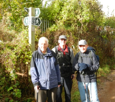
| L:R Tony Hibbitt (The Author of these walks) with John and Brian |
|
|
|
|
|
|
|
|
|
|
|
|
|