Monarch's Way - An Introduction to a 625 mile footpath
Monarch's Way T shirts and Hoodies
Monarch's Way Guide Books & Badges
Maps & Postcards of the Monarch's Way
Cotswolds Guide Books & Maps of the Monarch's Way
Warwickshire - The Monarch's Way
Temporary Amendments to The Monarch's Way
Places to Visit along The Monarch's Way
Walks Around The Monarch's Way
Bird News along The Monarch's Way
Amanda's Charity Walk Ham Hill to West Bay
Oak Apple Day 29th May 2012 Guildhall Worcester
Changes to the Route of the Monarch's Way
Minder's at work along the Monarch's Way
Trevor's Boot Relay Pictures part 2
Trevor's Boot Relay Pictures part 3
Trevor's Boot Relay Pictures part 4
Trevor's Boot Relay Pictures part 4A
Trevor's Boot Relay part 5 Book 2
The Monarch's way Relay part 8 (updated)
The Monarch's Way Relay part 9
The Celebration into Charmouth-Trevor's Boot Relay part 10
The Monarch's Way Relay part 11 Book 3
The Monarch's Way Relay Part 12
The Monarch's Way Relay part 13
The Monarch's Way Relay part 14
|
Amend 01. Book I. Section 1A Worcester to Droitwich - page 3. The 1:25,000 and 1:50,000 OS maps show the route from the Commandery as passing directly along the canal. It is possible to follow this route as it is waymarked.
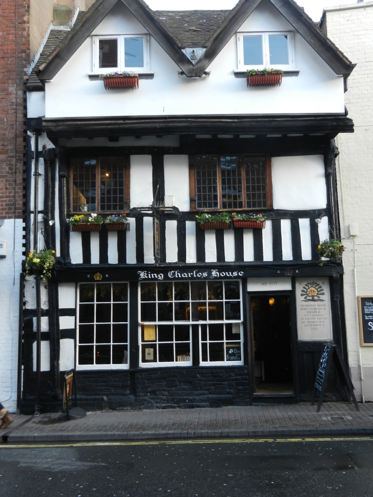
However the correct route which takes in King Charles House is as follows " Leave the towpath at Sudbury Bridge No 3 - and passing to the right of The Commandery walk north along Sidbury, cross Walls Road to then go right along Friar Street to eventually arrive at "King Charles House" It was here that the King was taken after quickly leaving the Commandery, but it was to offer no refuge for th story goes that no sooner had he arrived than Roundhead troopers started to beat down the front door. Charles managed to escape from the rear door by the skin of his teeth. From "King Charles House follow the pedestrian (tourist) signs for St Martins Gate and Shrub Hill Railway station. You will pass to the right of the Asda supermarket and continue through the side of the Asda car park under tunnel. Crossing the road in front you head towards the right hand side of Staples, soon arriving at Bridge 5 over the Worcester and Birmingham canal where you head north (left) along the towpath.
|
|
|
|
|
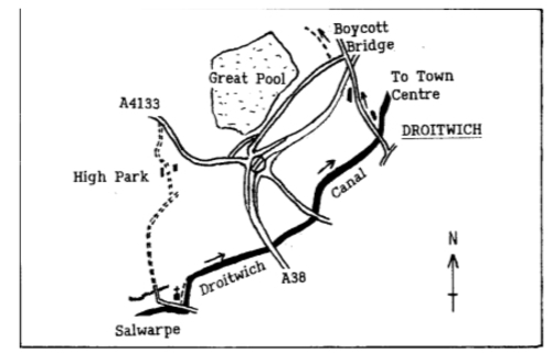
| Amend 02. Book I. Section 1A Worcester to Droitwich - page 5.
‘"Passing through Salwarpe Church’s lych gate, pass right of the church and along the edge of the churchyard to a pedestrian gate in the right corner. Through this follow a track the short distance down to the canal towpath. Joining the canal follow it forward (east) until reaching a third road bridge, immediately at which leave the canal to go left (north) on the roadside pavement to soon meet a junction and mini-traffic island. Here go left (signed Ombersley and Tenbury) and in about 100 yards meet a sign pointing right for Westwood. Adjacent to the sign go right through a gateway and left (left of allotments) to a gate".
Now back on the original route pick up the directions on page 6 (third sentence). Alternatively you may wish to end the first section by following the canal into the centre of Droitwich and then returning along the canal to pick up Section 2 at Boycott Bridge.
|
|
 |
|
| The arrows on the diagram above show the alternative route
|
|
|
|
|
| Amend 03. Book I. Section 4 Hagley to Stourton The entrance to Ham Dingle between bungalows 8 and 9 is now closed. The path is unsafe. The safe signed and waymarked alternative is to take Sandhurst Avenue following it to the north-west, where you soon arrive at a path on the left which you can follow through Ham Dingle on a wide path in the west- north-west direction to meet the A4036 |
|
|
|
|
| Amend 04. Book I. Section 13 Bentley Hall to Halesowen Abbey page 57 Over the last couple of years one of the two towpaths through the Netherton Tunnel has been closed leaving no choice but to follow the remaining one through the tunnel. As it happens this is the first one you come to so for those wishing to walk through the tunnel from the upper canal follow the steps down to the south-eastern towpath of the lower canal and go left to the tunnel entrance. It is hoped that the other towpath will be available at some time in the future but, as ever, it all comes down to money! Importantly if you intend to go through the Tunnel don't forget to bring a torch, plus some spare batteries !!!!! |
|
|
|
|
| Amend 05. Book I. Section 9 Kemberton to Norton (via Madeley) page 40 The current OS maps in this area are not correct and show the footpath in the wrong place through the wood and also as it passes across the golf course. The Correct route passes much further to the East through the wood and exits onto the golf course at (OS Grd Ref SJ 7020 0246). The correct route is waymarked through the woods and the new route over the Golf Course is as follows. Take care as you cross the Golf course and be careful to avoid the putting greens by going round them.
Exit the woods onto the Golf Course and immediately turn right to walk forward around the edge of the right hand wood to pick up and follow red painted Posts. Keeping to the right you reach the pond which is on the right. Continue along by the side of it for around 35 yards. At this point turn Left almost due North for 600 yards in total to carefully cross the Golf Course. Eventually aiming for a protruding group of trees / bushes by a bunker (Grid Ref SJ 7055 0272). At this point turn right to follow the right hand hedge to the top North East corner of the Golf Course (OS Grid Ref SJ 7063 0281).
Here turn right to take a stile and walk forward along the edge of a field with the hedge on your left. This will bring you to another step stile onto a road. |
|
|
|
|
| Amend 06. Book I. Section 18 - Wotton Wawen to Stratford This is about a change to the route through Snitterfield, north of Stratford-upon-Avon. The revised second edition of Book 1 indicates the correct route as does newer versions of 1:25 000 Ordnance Survey maps, however the first edition of Book 1 and also older versions of 1:50 000 scale Ordnance Survey maps are incorrect. The correct route is as follows page 85 second edition of Book 1. Turn left along Brearley Road to pass the Snitterfield Arms and the school to reach the crossroads. At the crossroads continue forward, passing the Foxhunter pub to your left and follow the right hand footway. When the footway ends continue forward and up to the t-junction and War Memorial, which is also a viewpoint. Here turn right to follow the roadside footway over a bridge that crosses the A46 (T) to turn immediately right into Kings Lane. Follow Kings Lane for about 600 yards to arrive at a road sign on the left stating Give Way - 150 yds. Just a few yards before this , also on the left, there is a public footpath marker post pointing along the drive to Snitterfield Fruit farm. If as suggested in the original Book 1 first edition and older 1:50 000 Ordnance Survey maps you turn right at the crossroads in Snitterfield village and then walk across fields to proceed to Kings Lane you have to cross the very very fast and almost impossible to cross Dangerous A46(T). The new route above is by far the safer route. |
|
|
|
|
|
|
|